


 Dark mode
 Light mode
43 Weather Videos

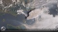
This timelapse shows the path of Tropical Cyclone Alfred up until the evening of the 5th or March 2025. Times shown are UTC, add 10 hours to get to Queensland local time, 11 hours for NSW.
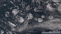
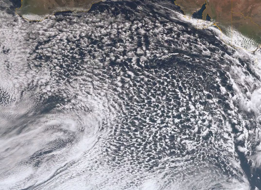
Cloud rosettes otherwise known as actinoform clouds in the Indian Ocean, off the coast of WA. For more information see NASA's Earth Observatory Page.
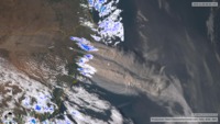
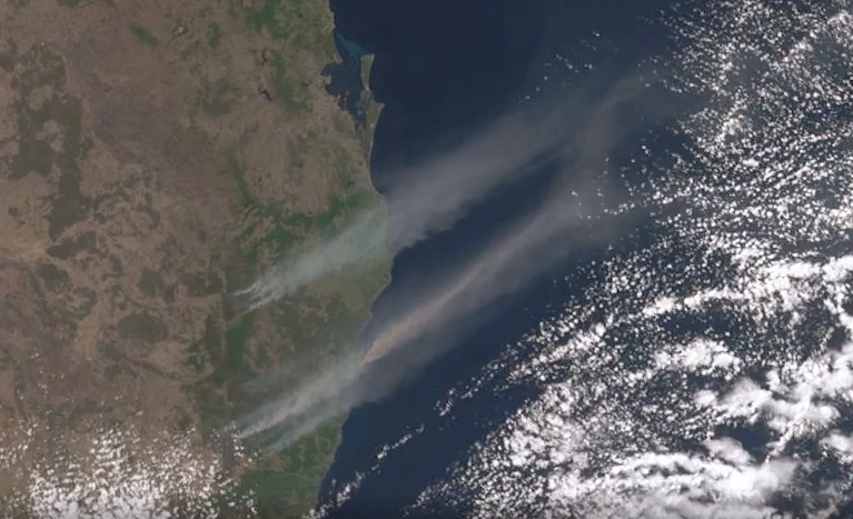
Unprecedented fires swept across northern NSW and southern Queensland causing a massive plume of smoke to sweep out to sea
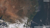
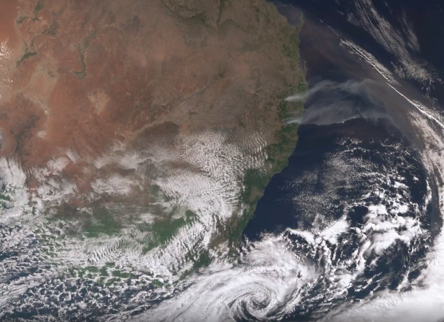
A cool change sweeping in from the southern ocean caused high winds and large areas of raised dust to be blown out over the Tasman towards New Zealand while bushfires continued to burn in norhtern NSW
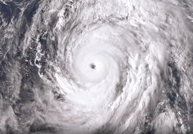
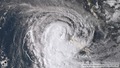
This video shows Typhoon Hagibis from creation through to just after 12th of October local time. Originally having developed into a super typhoon, Hagibis has has weakend slightly before approaching the Japanese coast. There is also a Standard Definition version of this video if you have limited bandwith and/or a small screen.
This video shows Typhoon Hagibis from creation through to just after 12th of October local time. Originally having developed into a super typhoon, Hagibis has has weakend slightly before approaching the Japanese coast. There is also a High Definition version of this video if you have good bandwith and at least a HD quality screen.
This video shows the bushfires in southern Queensland and northern NSW. The smoke is clearly visible during daylight ours, and at night with the black hot spots generated by the fires
This video shows extensive areas of raised dust across southern Queenland being blown out to sea along with a number of bushfires along the east coast while a wintry system pushes in over the south east bringing extensive snowfalls to the Alps in Victoria and NSW

This sequence shows the East Coast Low (ECL) that has caused extensive flooding down the east coast of Australia, including parts of houses being washed away in parts of Sydney

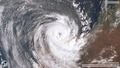
Tropical Cyclones Lam and Marcia struck the Australian cost almost simultaneously in Feburary 2015. Lam as a category 4, Marcia as a category 5. Both causing serious damage to the communities in their paths. This timelapse shows a false colour IR satellite and radar animation of the two cyclones forming, moving toward the coast, and disipating

This sequence shows Tropical Cyclone Oswald from formation through to the depression that caused severe flooding down the east coast of Australia between 20 and 29th of January 2013.

This video shows Tropical Cyclone Lua from formation, through to dissipation over Western Australia. Lua came ashore in the remote North West of Australia as a Category 4 Cyclone, the strongest Australia has seen since Tropical Cyclone Yasi last year


This Satellite & Radar timelapse shows Tropical Cyclone Heidi forming off the North West of Australia, before crossing over the coast at Port Hedland and heading inland.
Radar Imagery from the Australian BoM, Satellite from JMA, soundtrack 'Riding Spaces' from http://twitter.com/gbissett

This sequence shows Typhoon Talas from formation to dissipation. When this Typhoon struck Japan it caused numerous deaths and severe damage. This is one of the worse hurricanes to hit Japan recently.

This movie tracks Hurricane Irene from just before it being declared a Hurricane through to its passing over the Bahamas and it's approach to the US coast, and its dissipation up over Canada. Soundtrack 'Riding Spaces' by http://twitter.com/gbissett

Nanmadol has formed into a Typhoon before passing over the Philippines and is now on it's way to Taiwan as a weakened storm

Latest version: http://youtu.be/uLJS0KccI8U?hd=1
(Best in fullscreen HD). This movie tracks Hurricane Irene from just before it being declared a Hurricane through to its passing over the Bahamas and it's approach to the US coast. It is expected to glance the coast of Florida before making landfall around North Carolina.

This system was recognised as a tropical depression on the 25th of July, just over 900km west of Guam, before being recognised as a tropical storm on the 28th. By the 30th of July it was upgraded to a Typhoon, and rapidly strenghtened further to a Super Typhoon classification before weakening a little to a category 4 Typhoon. This storm is still developing, and heading towawrds Taiwan and mainland China.

Nock-ten formed as a low pressure system to the east of the Philippines on the 22nd of July, and was offically recognised as a tropical depression on the 24th of July. By the 27th it had strengthened to a category 1 Typhoon, and made landfall over the North of The Phillipines causing extensive damage. The storm weakened a little before strengthening again as it apparoached the South China Coast. After making landfall on China it drifted west further west and made landfall over Northern Vietnam before weakening rapidly.

Typhoon Ma-on started as a tropical depression around the 11th of July, and on the 12th offically became a tropical storm called Ma-on, Followed by typhoon on the 13th. Ma-on made landfall on Japan at Tokushima on the 19th, followed by Wakayama on the 20th, but by then had been downgraded to a tropical storm. Soundtrack 'Riding Spaces' by http://twitter.com/gbissett.

Super Typhoon Songda became the first Tyhpoon of the 2011 Pacific typhoon season. It passed to the east of the Phillipines, tracking up past Taiwan and before batterng Okinawa Japan with high winds and heavy rain.
Soundtrack 'Riding Spaces' by http://twitter.com/gbissett


This Satellite & Radar timelapse shows Tropical Cyclone Dianne forming off the North West of Australia, before moving down along the Western Australia coast and dissipating.

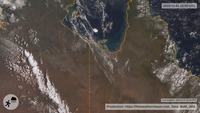
This Satellite & Radar timelapse shows Tropical Cyclone Carlos forming around Darwin and dumping record rainfalls across the region. It then moves inland, and out back over the ocean from Western Australia, re-strengthening and bringing significant falls the North West of Western Australia before moving out to sea and dissipating

This video starts as the first of a series of rain events impacts South Eastern Queensland, it the continues to follow these events as rain moves into Victoria. These rainfalls contributed to tragic, extensive flooding in Queensland, and unprecedented flooding across the a large swathe of North Western Victoria.

This timelapse uses false colour infrared imagery from JMA's MTSAT geostationary satellite & radar data from the Australia BoM to track the path of the Tropical Cyclone Yasi from when it forms until after it has impacted the Queensland Coast, and moved inland dissipating.

This timelapse uses false colour infrared imagery from JMA's MTSAT geostationary satellite & radar data from the Australia BoM to track the path of the full life cycle of Tropical Cyclone Anthony from forming to disipation over Queensland.
For the latest satellite imagery please visit For the most current versions of this satellite imagery see http://www.theweatherchaser.com/

This timelapse uses false colour infrared imagery from JMA's MTSAT geostationary satellite to track the path of the full life cycle of Tropical Cyclone Vince from forming to disipation off the coast of Western Australia.
For the latest satellite imagery please visit For the most current versions of this satellite imagery see http://www.theweatherchaser.com/

This timelapse uses false colour infrared imagery from JMA's MTSAT geostationary satellite to track the path of Tropical Cyclone Zelia forming and forming and rapidly travelling south over New Zealand & dissipating. At the start of the video you can see Tropical Cyclone Vania in the East, and then at the end you can see its remnants passing over the south of New Zealand.
For the latest satellite imagery please visit For the most current versions of this satellite imagery see http://www.theweatherchaser.com/

This timelapse uses false colour infrared imagery from JMA's MTSAT geostationary satellite to track the path of Tropical Cyclone Vania forming and travelling to the southern tip of New Caledonia, near Noumea in January 1011 before dissipating. For the latest satellite imagery please visit For the most current versions of this satellite imagery see http://www.theweatherchaser.com/

This timelapse uses false colour infrared imagery from JMA's MTSAT geostationary satellite to track the path of Typhoon Chaba forming and travelling towards Japan between October 19th to the 29th, 2010. You can also see Super Typhoon Megi to the West of Chaba in the first part of the video. For the latest satellite imagery please visit For the most current versions of this satellite imagery see http://www.theweatherchaser.com/

This timelapse uses false colour infrared imagery from JMA's MTSAT geostationary satellite to track the path of Super Typhoon Megi forming and travelling across the north of the Philippines, and fading out over China between October 10th to the 24th, 2010.


 Install

