


The Weather Chaser - Australian Weather Data & Analysis
We provide a number of resources including historical radar and observations, satellite imagery and analysis of weather data, in particular with respect to rainfall.
If you're looking to find out the relative frequency of a rain event, we provide Intensity Frequency Duration (IFD) design rainfalls with our observation exports. Find out more here.
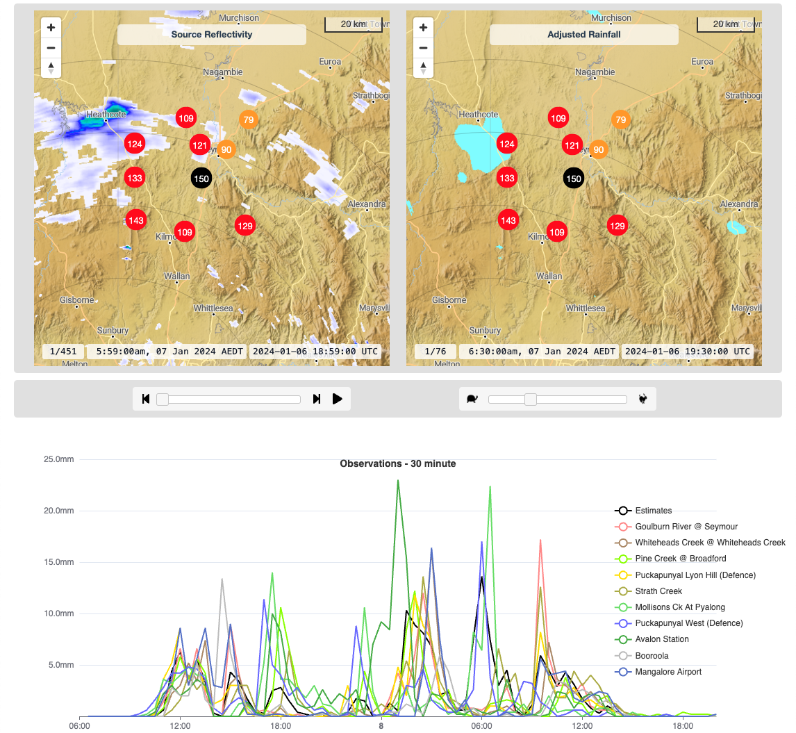
We can also provide custom weather data analysis services such as gauge corrected rainfall estimations using radar data. Find out more here.


Most active rain radars - Last Hour
Most active doppler wind radars - Last Hour
Rainfall Estimation -
Pricing -
Contact -
Terms & Conditions -
Privacy -
© theweatherchaser.com 2001-2024.
Free Registration
Register to get these additional features:
- Last 8 hours of data on the live weather map (satellite and radar)
- Last 8 hours of SD and HD radar imagery
- Last 3 days of AWS, rain gauge and river height observations
- Automatic update of live radar and observation data
- Save your options between use
- You can also then subscribe to access even more
The Weather Chaser provides access to the highest quality weather data available for Australia. By registering you can continue to access it, and help us ensure we can continue to provide free access to the latest high quality data.
Questions? Please contact us
Already registered? Please login
Subscribe Now
Thanks for being an active user of The Weather Chaser!
We endeavour to provide easy access to historical weather data, but as you can imagine, we have to manage an imense amount of data. As a regular user of our historical data we request you upgrade to a paid subscription.
These start at only $4 per month and allow us to continue to provide this service to yourself, and the wider community :
If you have any questions, including other access options, please don't hesitate to contact us